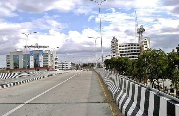
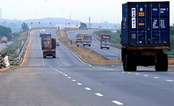
Narangi Bypass Road is an important urban road in Virar West, Maharashtra, particularly around Global City, Y K Nagar, Dongarpada and the New Viva College side. The road has become a familiar address for large residential developments, local shops, schools, restaurants and other services in the expanding western part of Virar. Unlike a national-highway bypass built mainly for long-distance through traffic, Narangi Bypass Road functions more as a local connector between the growing western neighbourhoods of Virar and the older town and station-side road network.
For visitors, the most useful landmarks are Global City, New Viva College, Y K Nagar and the broader Narangi Road connection towards Virar station. The road is also linked indirectly with the Mumbai-Ahmedabad highway corridor through Virar East and connecting roads. Because the name Narangi Bypass is used across several adjoining stretches and addresses, a complete building, society or junction name is important when booking a cab or giving directions. This guide covers the road location, rail and bus connectivity, nearby areas, access towards NH-48, traffic conditions and other practical details readers may need.
Quick About Narangi Bypass Road
| Particular | Details |
| Location | Virar West, Palghar district, Maharashtra |
| Common Local Reference | Narangi Bypass Road / Narangi Road, Global City side |
| Important Landmarks | Global City, New Viva College, Y K Nagar and Dongarpada |
| Nearby Areas | Gokul Township, Tirupati Nagar, Dongarpada, Y K Nagar, Bolinj and Virar West |
| Main Railway Station | Virar Railway Station |
| Railway Line | Western Railway suburban corridor |
| Bus Connectivity | VVMT/Vasai-Virar local buses, autos and cabs |
| Highway Access | NH-48 via Virar East and connecting roads |
| Nearest Major Airport | Chhatrapati Shivaji Maharaj International Airport, Mumbai |
| Road Character | Urban residential and commercial connector |
| Local Authority | Vasai-Virar City Municipal Corporation area |
| City / State | Virar, Maharashtra |
Where Is Narangi Bypass Road Located?
Narangi Bypass Road lies in Virar West and runs through the developing residential belt around Global City, Y K Nagar, Dongarpada and Tirupati Nagar. Government and official-address records repeatedly identify Global City and buildings near New Viva College with Narangi Bypass Road, confirming the road as a recognised local address rather than only an informal map label.
The road is west of Virar Railway Station. Narangi Road and local connecting streets provide movement towards the station and the older commercial part of Virar West. The western side continues into newer residential pockets and planned developments. For navigation, a complete reference such as “Narangi Bypass Road, Global City, Virar West” or the exact society name is more useful than entering only “Narangi Bypass”.
Connectivity of Narangi Bypass Road
Narangi Bypass Road is primarily valuable because it connects a large residential catchment in western Virar with Virar station, the local bus network and roads leading towards the Mumbai-Ahmedabad highway. The road is not itself part of NH-48, and travellers should not mistake it for a high-speed national-highway bypass.
Virar Railway Station Connectivity
Virar Railway Station is the main transport hub for Narangi Bypass Road. It is the northern terminus for many Mumbai suburban services on the Western Railway line and also handles several longer-distance trains. Depending on the exact point along Narangi Bypass Road, the station is only a few kilometres away by local road. Autos, local buses and cabs are the usual options for the final connection.
During weekday peak hours, station-side roads can become crowded. Passengers catching a fixed train should therefore keep extra time for the last stretch rather than estimating travel only from the short distance shown on a map.
NH-48 and Mumbai-Ahmedabad Highway Access
NH-48, the Mumbai-Ahmedabad highway, is the main long-distance road serving the Virar-Vasai region. Narangi Bypass Road does not join NH-48 directly. Vehicles generally move towards Virar East through the local east-west road network and then use connecting roads to reach the highway. This gives access towards Vasai, Mira-Bhayandar and Mumbai in the south and Manor, Palghar, Vapi and Gujarat in the north.
For long-distance driving, live navigation is especially useful because the best highway approach can change with traffic around railway crossings, flyovers and major junctions.
Bolinj, Agashi and Western Virar Connections
Narangi Bypass Road also connects conveniently with the wider Virar West road network towards Bolinj, Agashi and surrounding neighbourhoods. These local connections are important for residents travelling between newer housing clusters and older parts of Virar without first going to the railway station. Roads towards Arnala and the coastal side can also be approached through the wider Virar West network.
Bus and Auto Connectivity
Local bus services operate between Virar West and the Global City side. Current public-transport listings show stops such as Pan Phoi and Highway Phata serving the Narangi Bypass belt, with routes connecting the area to Virar West and other local destinations. Autos are also widely used for short trips to Virar station, schools, markets and nearby residential complexes.
A passenger should still check the exact stop because Narangi Bypass Road is a long local address and not one single bus terminal. The nearest useful stop may change depending on whether the destination is Global City, Y K Nagar, Dongarpada or another society along the road.
Airport Connectivity
Chhatrapati Shivaji Maharaj International Airport in Mumbai is the main airport used by Virar residents. The airport is a long road journey from Narangi Bypass Road, and travel time varies significantly with traffic through the western suburbs and highway approaches. For flights, travellers should keep a generous buffer and avoid planning the journey only on the basis of kilometre distance.
Nearby Areas Around Narangi Bypass Road
- Global City: One of the largest residential developments associated with Narangi Bypass Road and a major landmark for visitors.
- Y K Nagar: A residential locality directly linked with Narangi Bypass addresses and several nearby housing societies.
- Dongarpada: A local area along the Narangi Bypass belt with residential and neighbourhood commercial development.
- Tirupati Nagar: A well-known Virar West residential area close to the bypass and local bus routes.
- Gokul Township: An established residential locality adjoining the wider Narangi Bypass and Virar West road network.
- Bolinj: A nearby western Virar locality with local markets, residential areas and links towards Agashi and other western neighbourhoods.
Shops and Daily Facilities
Narangi Bypass Road passes through a heavily residential part of Virar, so daily-use facilities are available across the corridor. Grocery stores, pharmacies, restaurants, banks, clinics, schools and small commercial outlets operate in and around Global City, Y K Nagar, Tirupati Nagar and the station-facing side.
Larger shopping and service options are available closer to Virar station and established commercial areas of Virar West. Because development is spread over several housing clusters, the nearest hospital, school or supermarket can differ considerably from one end of the bypass to the other.
Traffic Conditions on Narangi Bypass Road
Traffic on Narangi Bypass Road is mainly local rather than interstate, but congestion can still develop during school hours, office commuting periods and evening shopping time. Station-bound traffic is usually the most sensitive because several residential roads feed into the same Virar West approaches.
The monsoon also deserves attention. Virar and the wider Vasai-Virar region can experience intense rainfall, and local low-lying stretches may slow down during heavy showers. Drivers should follow current municipal and traffic updates during severe rain instead of assuming that the normal quickest route will remain open and equally fast.
Conclusion
Narangi Bypass Road is an important local connector in Virar West, serving Global City, Y K Nagar, Dongarpada, Tirupati Nagar and other fast-growing residential pockets. Its biggest transport advantage is convenient access to Virar Railway Station and the wider Virar West road network, with onward connections towards NH-48 through Virar East. Because it is an urban road rather than a single national-highway bypass, visitors should always use a complete landmark or society name when travelling. For most readers, Global City, New Viva College and Virar Railway Station are the most useful reference points for understanding the road.
FAQs About Narangi Bypass Road, Virar
Q1. Is Narangi Bypass Road a national highway bypass?
No. It is an urban road in Virar West serving residential and commercial areas. NH-48 is the major national highway for long-distance traffic, but it is reached through connecting roads rather than directly from every point on Narangi Bypass Road.
Q2. What is the most reliable landmark for finding Narangi Bypass Road?
Global City and New Viva College are among the clearest references. Y K Nagar and Dongarpada are also useful depending on the exact address. Always include the society or building name when booking a cab.
Q3. How should I reach Narangi Bypass Road from Virar Railway Station?
Auto-rickshaws, local buses and cabs are the practical options. The distance is short, but travel time can increase during station peak hours, so allow extra time if you have an appointment or onward journey.
Q4. Can I use Narangi Bypass Road to reach the Mumbai-Ahmedabad highway?
Yes, but the road does not function as a direct NH-48 interchange. You need to use the Virar east-west road network and the appropriate highway connection. Live navigation is useful because traffic conditions can change the preferred route.
Q5. Which bus stop should I use for Global City or the Narangi Bypass area?
Stops such as Pan Phoi and Highway Phata serve parts of the corridor, while local routes also connect Global City with Virar West. The best stop depends on the exact building or society, so check the latest route and stop before travelling.
Q6. Does monsoon rain affect travel on Narangi Bypass Road?
Heavy rain can slow local traffic in the Virar-Vasai area, particularly where water accumulates or junction traffic becomes congested. During severe weather, check live traffic and municipal advisories before leaving.
Q7. Is parking easy along Narangi Bypass Road?
Parking availability depends on the individual society, commercial building or establishment. The road itself should not be treated as guaranteed long-term parking space, especially near busy junctions and shop clusters.
Q8. Why do some addresses say Narangi Road while others say Narangi Bypass Road?
Local addresses and map labels use both names for connected stretches in the Narangi-Virar West area. For deliveries, taxis and property visits, the full society name, landmark and locality are more dependable than the road name alone.