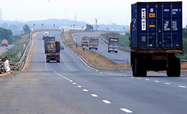
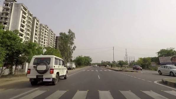
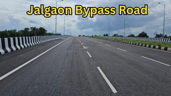
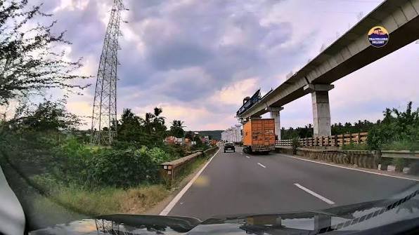
Rayakottai Bypass Road is a newly completed national-highway bypass around Rayakottai town in Krishnagiri district, Tamil Nadu. It forms part of NH-844, the four-lane Hosur-Dharmapuri corridor developed as an alternative to the busier NH-44 route. The bypass allows through vehicles to avoid the narrow market and town roads of Rayakottai and continue more directly towards Hosur, Dharmapuri, Palacode and Bengaluru-side connections.
Official highway fee notifications identify the Rayakottai Bypass between chainage 45+200 and 49+900 on NH-844, giving the bypass an end-to-end span of about 4.7 km. The notified chargeable highway length is about 4.27 km after excluding two long structures. The road became usable for through traffic in mid-2026, making the NH-844 route substantially easier for travellers who previously had to pass through Rayakottai town or use temporary construction diversions. This guide explains the exact location, road connections, railway and bus access, nearby areas, toll position, traffic conditions and other practical details.
Quick About Rayakottai Bypass Road
| Particular | Details |
| Location | Rayakottai, Krishnagiri district, Tamil Nadu |
| Main Highway | NH-844 |
| Bypass Chainage | 45+200 to 49+900 |
| Approximate End-to-End Length | About 4.7 km |
| Road Type | Four-lane national-highway bypass |
| Main Purpose | Avoid Rayakottai town traffic on the Hosur-Dharmapuri route |
| Major Connections | Hosur, Kelamangalam, Palacode, Dharmapuri and Bengaluru-side routes |
| Nearby Areas | Rayakottai, Kelamangalam-side villages, Marandahalli-side routes and Palacode corridor |
| Nearest Railway Station | Rayakkottai Railway Station (RYC) |
| Nearest Major Airports | Kempegowda International Airport, Bengaluru; Salem Airport for limited regional services |
| Toll Corridor | NH-844 Hosur-Dharmapuri project |
| District / State | Krishnagiri, Tamil Nadu |
Where Is Rayakottai Bypass Road Located?
Rayakottai Bypass lies around the outer side of Rayakottai town on NH-844. The bypass was built as part of Package II of the larger Hosur-Dharmapuri four-laning project. It separates through highway traffic from the older road through Rayakottai market and bus-stand area, where congestion had been a regular problem for long-distance vehicles.
For route planning, the bypass is best understood as the NH-844 segment immediately around Rayakottai rather than a local municipal road. Vehicles approaching from Hosur and Kelamangalam can continue onto the bypass and rejoin the Dharmapuri-facing highway beyond the town. Local traffic can still enter Rayakottai through the appropriate connecting roads and service-road approaches.
Connectivity of Rayakottai Bypass Road
Hosur Connectivity
NH-844 connects Rayakottai with Hosur to the north-west. This is one of the most important uses of the bypass because the wider NH-844 corridor provides an alternative route between the Hosur-Bengaluru side and Dharmapuri. Travellers heading towards Hosur can continue through the Kelamangalam-side stretch and then use the appropriate connection towards Hosur and NH-44.
Dharmapuri Connectivity
South-east of Rayakottai, NH-844 continues towards Palacode and Dharmapuri. The route eventually connects back with NH-44 near the Dharmapuri side. For travellers moving between Bengaluru or Hosur and western or southern Tamil Nadu, the corridor can reduce dependence on the Krishnagiri-side NH-44 route, depending on the final destination.
Palacode and Marandahalli-Side Connections
Rayakottai also has road connections towards Marandahalli and Palacode. Palacode lies directly on the NH-844 corridor farther south and serves as an important intermediate town before Dharmapuri. Local and district roads from Rayakottai also connect with surrounding rural areas, so highway users should follow the main NH-844 signs rather than smaller town roads when they intend to remain on the bypass.
Bengaluru and NH-44 Access
The wider NH-844 project is designed as an alternate Hosur-Dharmapuri corridor and ultimately links with NH-44. This gives Rayakottai Bypass strategic importance for traffic moving between Bengaluru, Hosur, Dharmapuri and onward routes towards Salem and Coimbatore. The exact connection used near the Bengaluru end depends on the latest opening status of the Neraluru-Hosur-side interchange and connecting works.
Railway Connectivity
Rayakkottai Railway Station, station code RYC, is the local railway station serving the town. It lies on the Hosur-Dharmapuri railway line and has two platforms. The station is useful for the limited trains that halt there, while Hosur and Dharmapuri provide broader rail choices depending on the direction of travel.
The bypass does not run through the station area, so passengers should leave NH-844 at the correct town access and use local roads, autos or other transport for the final distance. Travellers with a fixed train should allow extra time because bypass exits and service-road approaches may not be the same as the older direct town route.
Bus Connectivity
Rayakottai has local and intercity bus services towards Hosur, Dharmapuri and nearby towns. Some private operators also use Rayakottai Bypass as a highway pickup point, while others continue to use the main bus stand inside town. Passengers should therefore check the latest ticket or operator message before deciding where to wait.
A boarding instruction that says “Rayakottai Bypass” may refer to a petrol bunk, junction or another highway-side landmark rather than the central bus stand. This distinction matters more now that through buses can avoid the town centre entirely.
Airport Connectivity
For most air travellers, Kempegowda International Airport in Bengaluru is the more useful major airport because it offers a wide range of domestic and international flights. Krishnagiri district also identifies Salem Airport as a nearby airport for the district, but its route network is much smaller. The better airport choice depends on the available flight and onward road journey.
Travellers heading to Bengaluru airport should allow a large time buffer because the journey includes the Hosur-Bengaluru approach and can be affected by traffic near the metropolitan area. Using distance alone to estimate airport travel time is not advisable.
Nearby Areas Around Rayakottai Bypass Road
- Rayakottai Town: The main local centre served by the bypass, with the bus stand, markets, railway station and everyday services.
- Kelamangalam: A major town on the Hosur-facing side of the wider corridor and an important road reference for northbound traffic.
- Marandahalli: A nearby town connected through local roads and the railway corridor south-east of Rayakottai.
- Palacode: An important town farther south on NH-844 and a key intermediate point before Dharmapuri.
- Hosur: The major industrial city to the north-west and the main gateway towards Bengaluru and NH-44.
- Dharmapuri: The major district city at the southern end of NH-844, providing onward access towards Salem and other parts of Tamil Nadu.
Toll and Highway Facilities
Rayakottai Bypass is part of the tolled NH-844 Hosur-Dharmapuri project. Government fee notifications specifically list Rayakottai Bypass in two chainage segments, from 45+200 to 47+000 and from 47+000 to 49+900, with separate treatment for long structures. The actual amount paid by a vehicle depends on the fee plaza crossed and the current notified rate, so older toll figures should not be treated as permanent.
Fuel stations, small eateries and local services are available around Rayakottai and the wider highway corridor. However, the bypass itself is a through-road, so travellers should not expect the same density of shops as inside the town market area.
Traffic Conditions on Rayakottai Bypass
The biggest advantage of the bypass is that it removes a large share of through traffic from Rayakottai town. Before the bypass opened, vehicles on the Hosur-Dharmapuri route had to slow considerably around the market, bus stand and railway-side urban roads. The bypass now provides a more direct four-lane route for cars, buses and commercial vehicles.
As with any newly completed highway section, drivers should still watch for service-road entries, merging local traffic and temporary finishing work. Speed should be adjusted near junctions and structures, especially during rain or low visibility. Live navigation is also useful because adjoining NH-844 packages may still see local construction or traffic-management changes.
Current Status of Rayakottai Bypass
The Rayakottai Bypass was under construction through 2025 and the first half of 2026 as part of NH-844 Package II. Recent road-user reports from July and August 2026 confirm that the bypass has opened and is functioning in both directions, allowing motorists to avoid Rayakottai town. This is an important improvement for the wider Hosur-Dharmapuri corridor because Rayakottai had remained one of the main bottlenecks even after large parts of NH-844 became usable.
Conclusion
Rayakottai Bypass Road is a genuine national-highway bypass on NH-844 and an important improvement to the Hosur-Dharmapuri corridor. Running around Rayakottai between chainage 45+200 and 49+900, it allows through traffic to avoid the congested town centre and provides smoother movement towards Hosur, Kelamangalam, Palacode and Dharmapuri. With the bypass now functioning in both directions, the route has become far more practical for long-distance travellers. The main points to remember are to use the correct town exit for local destinations, verify the exact bus pickup landmark and follow current NH-844 traffic signs where adjoining project work continues.
FAQs About Rayakottai Bypass Road
Q1. Is Rayakottai Bypass now open to traffic?
Yes. Recent road-user updates from mid-2026 indicate that the bypass is open in both directions and through vehicles can avoid Rayakottai town. Drivers should still follow current signs because adjoining NH-844 works may continue in some locations.
Q2. Is Rayakottai Bypass part of NH-844?
Yes. The bypass is an official part of NH-844 and is specifically identified in government toll notifications between chainage 45+200 and 49+900.
Q3. Does the bypass completely avoid Rayakottai market and bus-stand traffic?
For through highway traffic, yes. The main purpose of the bypass is to route vehicles around the congested town centre. Local travellers heading to the bus stand, railway station or market must leave the bypass at the appropriate access road.
Q4. Is the bypass useful for Bengaluru-to-Dharmapuri travel?
Yes. NH-844 is designed as an alternative Hosur-Dharmapuri corridor and can be useful for traffic coming from the Bengaluru-Hosur side. The overall advantage depends on the exact Bengaluru approach, current interchange status and final destination.
Q5. Are tolls charged specifically for Rayakottai Bypass?
The bypass is included in the wider NH-844 toll framework. What a vehicle pays depends on the fee plaza crossed, vehicle category and current notified rate rather than a simple flat entry charge for the bypass alone.
Q6. Which railway station should a traveller use for Rayakottai?
Rayakkottai Railway Station is the local station. For a wider range of trains, Hosur or Dharmapuri may be more practical depending on the route and train schedule.
Q7. What should bus passengers do if the ticket says Rayakottai Bypass?
They should confirm the exact landmark with the operator. A bypass pickup may be at a petrol bunk or highway junction and may not be the same as Rayakottai Bus Stand inside town.