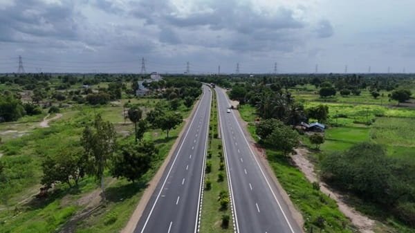
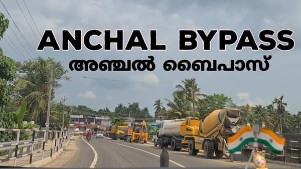
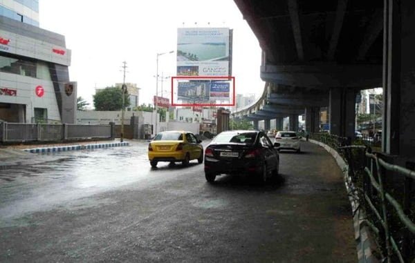
Miryalaguda Bypass Road is an established road corridor on the outer side of Miryalaguda in Nalgonda district, Telangana. The bypass name is commonly used around the Adavidevulapally and Ramachandragudem side of the town, where through traffic can move between the Nalgonda, Sagar, Guntur and Kodad-facing roads without depending entirely on the busier streets of central Miryalaguda. Official fuel-station addresses also use “Bypass Road, Adavidevulapally, Miryalaguda,” confirming that this is a genuine local bypass-road reference rather than only a junction name.
Miryalaguda is an important commercial and agricultural centre with strong road and rail links to Nalgonda, Hyderabad, Nagarjuna Sagar, Kodad and the Andhra Pradesh border. The town is also connected with NH-167, whose Miryalaguda-Kodad section has been upgraded to two lanes with paved shoulders. For intercity passengers, “Miryalaguda Bypass” is also used as a boarding and dropping point by private and state-run bus services. This guide explains the bypass location, major road connections, railway and bus access, nearby areas, traffic conditions and practical details readers may need.
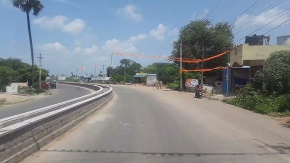
Quick About Miryalaguda Bypass Road
| Particular | Details |
| Location | Outer Miryalaguda, mainly around Adavidevulapally and Ramachandragudem |
| Main Highway Connection | NH-167 / Miryalaguda-Kodad corridor |
| Important Local References | Guntur Road, Kodad X Road, Nalgonda Road and Sagar Road |
| Road Type | Urban bypass and intercity through-traffic corridor |
| Nearby Areas | Adavidevulapally, Ramachandragudem, Gudur, Venkatadripalem and Bangarugadda |
| Bus Connectivity | TGSRTC and private buses; bypass-side boarding/drop points are commonly used |
| Nearest Railway Station | Miryalaguda Railway Station |
| Nearest Major Airport | Rajiv Gandhi International Airport, Hyderabad |
| Regional Connections | Nalgonda, Kodad, Nagarjuna Sagar, Guntur and Hyderabad-side routes |
| Road Character | Residential, commercial, transport and highway-oriented corridor |
| District | Nalgonda |
| State | Telangana |
Where Is Miryalaguda Bypass Road Located?
Miryalaguda Bypass Road is generally associated with the outer eastern and south-eastern side of the town, especially around Adavidevulapally. Current IndianOil records place a fuel station directly on “Bypass Road, Adavidevulapally, Miryalaguda,” with the nearby locality described as Guntur Road/Kodad X Road. Commercial addresses also use “Addanki Bypass Road” around Ramachandragudem, showing how the bypass name is used across the larger outer-road belt.
Because the bypass serves several radial roads, it is better to navigate using the complete address or a nearby junction rather than entering only “Miryalaguda Bypass.” A bus pickup on the Kodad-facing side, for example, may not be the same location as an address near Sagar Road or the Nalgonda approach.
Connectivity of Miryalaguda Bypass Road
NH-167 and Kodad Connectivity
NH-167 is the most important national-highway connection around Miryalaguda. The Miryalaguda-Kodad section runs east towards Kodad and links the town with the NH-65 corridor, which provides onward access towards Hyderabad and Vijayawada-side routes. The upgraded Miryalaguda-Kodad section was inaugurated in 2024 as a two-lane road with paved shoulders, improving regional through movement.
Nalgonda Connectivity
Miryalaguda is connected with Nalgonda through the north-western road network. The municipality places Nalgonda about 45 km from Miryalaguda. For travellers approaching from Nalgonda, the bypass provides access to the outer parts of town and onward roads without requiring every vehicle to pass through the central commercial area.
Nagarjuna Sagar and Sagar Road
Sagar Road is another important local and regional connection. It serves traffic towards Nagarjuna Sagar and nearby mandals and also meets the wider bypass-side road system around Miryalaguda. Addresses near the bypass and Sagar Road are often close to fuel stations, warehouses, rice-mill activity and other highway-oriented businesses.
Guntur and Andhra Pradesh-Side Connectivity
Miryalaguda has a long-standing road connection towards Guntur district through the Krishna River crossing at Wadapally. The Guntur Road and Kodad X Road side of the bypass is therefore an important reference for travellers heading south-east or towards Andhra Pradesh. The best route depends on whether the destination is Guntur, Piduguralla, Dachepalli or another town in the region.
Railway Connectivity
Miryalaguda Railway Station is the main rail access point for the town. The municipality confirms that Miryalaguda lies on the broad-gauge Bibinagar-Nadikudi railway line, while South Central Railway records show Miryalaguda as an established station on the Nalgonda-Nadikudi corridor.
The station is inside the urban area rather than directly on the bypass. Passengers starting from Adavidevulapally or another bypass-side location should use an auto, cab or local bus for the final journey and keep additional time during busy road periods.
Bus Connectivity
Miryalaguda has a major TGSRTC bus station in the Nalgonda region and regular services towards Nalgonda, Hyderabad, Kodad, Huzurnagar, Nagarjuna Sagar and other destinations. The bypass is also widely used by private intercity buses as a boarding and dropping point.
Passengers should check the exact pickup landmark before travelling. Bus-booking and operator listings may show “Miryalaguda Bypass,” “Miryalaguda By Pass,” or a nearby road reference. These do not always mean the main bus station, and the pickup may be on the highway side near a petrol pump, junction or commercial establishment.
Airport Connectivity
Rajiv Gandhi International Airport in Hyderabad is the nearest major airport with extensive domestic and international connectivity. Road distance from Miryalaguda is roughly 160 km, depending on the starting point and route. For most air passengers, travelling by road towards Hyderabad is the practical option, although a train to the Hyderabad-Secunderabad area followed by an airport transfer can also be considered.
Because the airport journey is long, passengers should allow a generous buffer for highway traffic, city congestion and possible delays near Hyderabad.
Nearby Areas Around Miryalaguda Bypass Road
- Adavidevulapally: The most important bypass-side locality reference, with fuel stations and road links towards Guntur Road and Kodad X Road.
- Ramachandragudem: A bypass-side area where commercial addresses use the Addanki Bypass Road name.
- Gudur: A nearby locality on the outer Miryalaguda road network with access towards bypass-side commercial and residential areas.
- Venkatadripalem: An adjoining area connected with Miryalaguda municipality and the railway-side urban belt.
- Bangarugadda: A local road reference on the Nalgonda Road side of Miryalaguda.
- Central Miryalaguda: The main market, administrative and bus-station area, reached from the bypass through city-entry roads.
Shops and Daily Facilities
The bypass-side belt is more developed than a remote highway corridor. Fuel stations, vehicle-service outlets, restaurants, small hotels, warehouses, dealerships and local shops are available around Adavidevulapally, Guntur Road and the main junctions. Miryalaguda is also a major rice-milling and agricultural centre, so commercial and goods traffic is common around the outer roads.
For larger hospitals, banks, markets and government services, central Miryalaguda offers more options. Visitors staying on the bypass should check the exact distance to the town centre rather than assume that every service is directly beside the road.
Traffic Conditions on Miryalaguda Bypass
Traffic on the bypass is a mix of buses, cars, two-wheelers, agricultural vehicles and goods traffic. The road helps through vehicles avoid some central-town congestion, but busy junctions can still slow movement, particularly where Nalgonda Road, Sagar Road, Guntur Road and the Kodad-facing corridor meet the bypass-side network.
Drivers should be cautious around bus pickup points, fuel stations and roadside commercial entrances. Recent accident reporting has also highlighted the need for careful driving on the Miryalaguda Bypass, especially at night and at junctions where local traffic enters the main road.
Current Highway Development Around Miryalaguda
The larger road network around Miryalaguda has been upgraded through NH-167 projects. The Miryalaguda-Kodad section covers about 47 km and was upgraded to two lanes with paved shoulders. The Alinagar-Miryalaguda section has also been under rehabilitation and upgradation, improving the western approach to the town.
These national-highway works are separate from the local bypass-road name used inside and around Miryalaguda, but they improve the routes that feed into the bypass. Travellers should continue to follow current signs and temporary diversions because finishing works or maintenance can affect local traffic flow.
Conclusion
Miryalaguda Bypass Road is a genuine and useful outer-town road corridor serving Miryalaguda in Nalgonda district. It is most closely associated with the Adavidevulapally and Ramachandragudem side and connects traffic with NH-167, Nalgonda Road, Sagar Road, Guntur Road and Kodad-facing routes. The bypass also functions as a regular intercity bus pickup reference and gives access to Miryalaguda Railway Station and the wider regional transport network. For visitors, the most practical step is to use the exact bypass locality or junction rather than treating “Miryalaguda Bypass” as one single point.
FAQs About Miryalaguda Bypass Road
Q1. Is Miryalaguda Bypass a genuine bypass-road reference?
Yes. Official IndianOil addresses use “Bypass Road, Adavidevulapally, Miryalaguda,” and the road is also used as an established intercity bus pickup and dropping reference.
Q2. Is Miryalaguda Bypass the same as NH-167?
Not exactly. NH-167 is the major national-highway corridor through the Miryalaguda region. The local bypass road connects with and serves traffic from this corridor, but the terms should not be treated as identical for every address or junction.
Q3. Which side of the bypass is most useful for Kodad-bound traffic?
The Guntur Road/Kodad X Road side around Adavidevulapally is an important reference for eastbound movement towards the Miryalaguda-Kodad NH-167 section. Drivers should still follow the current signed route.
Q4. If my bus ticket says Miryalaguda Bypass, should I go to the main bus station?
Not automatically. Many private operators use a bypass-side pickup rather than Miryalaguda Bus Station. Check the exact landmark, operator message and side of the road before leaving.
Q5. Can the bypass be used for Nagarjuna Sagar-side travel?
Yes. The bypass-side road network connects with Sagar Road, which serves Nagarjuna Sagar and nearby areas. The correct turn depends on the exact starting point on the bypass.
Q6. Which railway station should bypass-side travellers use?
Miryalaguda Railway Station is the town’s main railway station. It is inside the urban area, so bypass-side passengers need a short local road transfer.
Q7. Why is the exact bypass landmark important?
The bypass name is used across a fairly broad outer road belt. Adavidevulapally, Ramachandragudem, Guntur Road and Sagar Road can refer to different approach points, so a complete landmark prevents navigation and bus-pickup confusion.