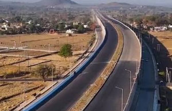
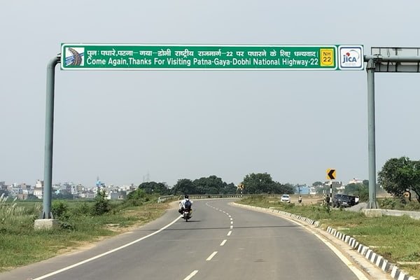
Anakapalle Bypass Road is an important part of the NH-16 corridor in Anakapalle, Andhra Pradesh. The bypass carries through traffic around the main town and forms part of the busy east-coast highway linking Visakhapatnam with Tuni, Rajahmundry, Vijayawada and destinations farther south. On the Anakapalle side, the road is commonly associated with localities and landmarks around Kothuru, Ammulapalem and Pisinikada. It is used by local commuters, buses, freight vehicles and long-distance traffic moving along the Chennai-Kolkata highway corridor.
The term can sometimes cause confusion because the larger Anandapuram-Pendurthi-Anakapalle six-lane NH-16 corridor is also described as the Visakhapatnam bypass. For local addresses, however, “Anakapalle Bypass Road” usually means the NH-16 stretch around Anakapalle town itself. This guide explains the location, major road links, railway and airport access, bus connectivity, nearby areas, traffic conditions and other practical details readers may need.
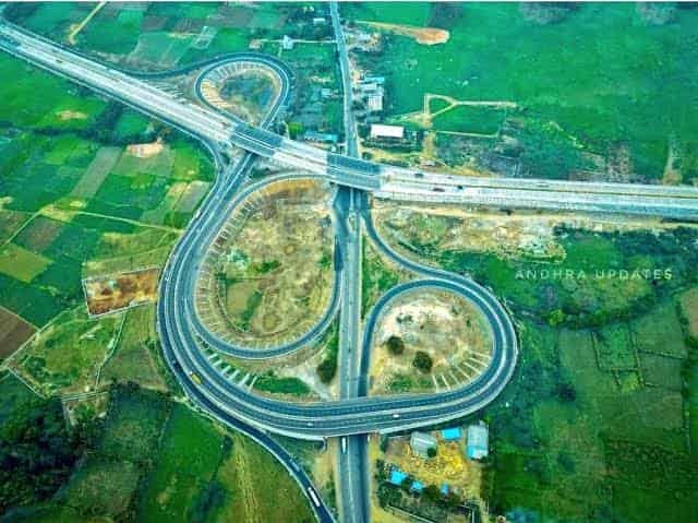
Quick About Anakapalle Bypass Road
| Particular | Details |
| Location | Around Anakapalle town in Anakapalli district, Andhra Pradesh |
| Major Highway | NH-16 / Chennai-Kolkata east-coast corridor |
| Common Bypass Landmarks | Kothuru/Kothru, Ammulapalem and Pisinikada |
| Important Connections | Anakapalle town roads, Sabbavaram side and Visakhapatnam corridor |
| Nearby Areas | Kothuru, Pisinikada, Ammulapalem, Kasimkota and Sankaram |
| Bus Connectivity | APSRTC buses, private buses, autos and cabs |
| Nearest Railway Station | Anakapalle Railway Station (AKP) |
| Nearest Airport | Visakhapatnam Airport |
| Road Character | National highway bypass with local, intercity and freight traffic |
| City / State | Anakapalle, Andhra Pradesh |
Where Is Anakapalle Bypass Road Located?
Anakapalle Bypass runs along NH-16 on the outer side of Anakapalle town. The highway allows long-distance vehicles to move past the town without depending entirely on the busier internal streets. Local references along the bypass include Kothuru, where the A.M.A.L. College bypass junction is a useful landmark, as well as Pisinikada and Ammulapalem. These points are convenient for people joining NH-16 from different parts of Anakapalle.
The bypass is part of one of Andhra Pradesh’s most important north-south road corridors. Northbound traffic can continue towards Visakhapatnam and, through the wider NH-16 network, towards Vizianagaram and Srikakulam. Southbound traffic travels towards Yelamanchili, Tuni, Rajahmundry, Vijayawada and the coastal districts beyond.
Connectivity of Anakapalle Bypass Road
Connectivity is the main advantage of Anakapalle Bypass. The road serves both local movement around the town and long-distance travel along NH-16, while nearby junctions provide links towards industrial areas, suburban settlements and Visakhapatnam.
NH-16 Connectivity
NH-16 is the principal road through the bypass area. It is part of the Golden Quadrilateral and the larger Kolkata-Chennai highway corridor. From Anakapalle, the highway provides a direct road connection towards Visakhapatnam in the north-east and towards Tuni, Rajahmundry and Vijayawada in the south-west. Because the corridor carries buses, cars, trucks and freight traffic, it remains busy through much of the day.
Visakhapatnam and Sabbavaram Side
Anakapalle is closely connected with the western and southern approaches to Visakhapatnam. The six-lane Anandapuram-Pendurthi-Anakapalle section of NH-16 provides an important alternative route for through traffic around the Visakhapatnam urban area. The corridor includes the Sabbavaram side and helps connect Anakapalle with Pendurthi, Anandapuram and roads serving the wider Visakhapatnam Metropolitan Region.
Kasimkota, Yelamanchili and Tuni Side
South of Anakapalle, NH-16 continues towards Kasimkota, Yelamanchili, Nakkapalle and Tuni. These links are important for daily travel as well as intercity movement along the coast. People travelling to industrial, educational or residential locations outside Anakapalle can generally join the highway from the bypass without entering the town centre.
Railway Connectivity
Anakapalle Railway Station, with station code AKP, is the main railway station serving the town and bypass area. It lies on the important Howrah-Chennai main line and is part of the Vijayawada railway division. The station provides access to passenger and express services towards Visakhapatnam, Vijayawada and other cities on the east-coast rail corridor.
The exact distance from the bypass depends on the starting point, but the station is within practical road reach from Kothuru, Pisinikada and other bypass-side localities. Autos and cabs are generally convenient for passengers carrying luggage, while local transport options may vary by time and location.
Bus Connectivity
Anakapalle has strong bus connectivity through APSRTC and private operators. The main bus station serves local and intercity routes, while the bypass is also used as a separate boarding and logistics point. APSRTC records list an Anakapalle Bypass counter in addition to the main Anakapalle bus-station counter, showing the importance of the bypass for road-based transport.
Passengers using a private or long-distance bus should check the exact boarding landmark on the latest ticket. A service may stop at the town bus station, at the bypass, or at a specific highway-side pickup point. Reaching only “Anakapalle” without checking the stop name can result in extra travel at the last minute.
Airport Connectivity
Visakhapatnam Airport is the nearest major airport to Anakapalle. The road distance from central Anakapalle is roughly around 28 km, although the exact distance from a bypass-side address varies. Travel is generally through the Visakhapatnam-side road network, and cabs are the simplest option for passengers carrying luggage.
Airport travel time can vary because traffic conditions around Visakhapatnam, Gajuwaka and connecting roads are not constant. Passengers with a fixed flight departure should therefore keep a reasonable buffer rather than relying only on the normal driving time.
Nearby Areas Around Anakapalle Bypass Road
Kothuru / Kothru: A key bypass-side locality and a useful navigation reference. The A.M.A.L. College bypass junction on NH-16 is located in this area.
Pisinikada: A locality on the NH-16 side of Anakapalle with highway-oriented businesses and direct bypass access.
Ammulapalem: Another bypass-side locality where addresses commonly use “Anakapalle Bypass Road” as the road reference.
Kasimkota: Located south-west of Anakapalle and connected directly through the NH-16 corridor.
Sankaram: A nearby area associated with the well-known Bojjannakonda and Lingalakonda Buddhist heritage sites, reachable from Anakapalle by local roads.
Sabbavaram: Located on the broader Anakapalle-Visakhapatnam bypass corridor and important for connections towards Pendurthi and the wider metropolitan region.
Shops and Daily Facilities
The Anakapalle Bypass corridor has a mix of fuel stations, restaurants, vehicle-service businesses, small shops and other highway-oriented facilities. More extensive shopping, banking, healthcare and everyday services are available inside Anakapalle town. The bypass also has fuel stations and service points around Kothuru, Pisinikada and Ammulapalem, which is useful for long-distance drivers.
People choosing a hotel, office or residence near the bypass should check the exact side of NH-16 and the nearest service road or junction. A property that appears close on a map may require a longer approach if median openings or safe turning points are limited.
Traffic Conditions at Anakapalle Bypass
Traffic on Anakapalle Bypass can be heavy because NH-16 carries a large volume of long-distance and freight movement in addition to local vehicles. Buses and trucks are common, and traffic can slow near junctions, service-road entries and busy commercial points. Rain, road maintenance, accidents or temporary diversions can also change journey times.
Drivers should follow current signs and lane markings and avoid making unsafe turns across fast-moving highway traffic. Pedestrians and two-wheeler users should be especially careful around bypass junctions. For train, bus or flight departures, leaving some extra time is advisable during morning and evening peak periods.
Conclusion
Anakapalle Bypass Road is an important NH-16 corridor serving Anakapalle and the wider Visakhapatnam region. Its links towards Visakhapatnam, Sabbavaram, Kasimkota, Yelamanchili, Tuni and the broader east-coast highway network make it important for local commuters, buses and long-distance traffic. The town’s own railway station and relatively convenient road access to Visakhapatnam Airport add to its transport value. For visitors, the most useful step is to confirm whether an address or bus pickup is at Kothuru, Pisinikada, Ammulapalem or another bypass-side point before starting the journey.
FAQs About Anakapalle Bypass Road
Q1. Is Anakapalle Bypass Road on NH-16?
Yes. The commonly used Anakapalle Bypass Road is part of the NH-16 highway corridor that bypasses the main town area.
Q2. Which landmark is useful for finding Anakapalle Bypass?
Kothuru and the A.M.A.L. College bypass junction are useful references. Pisinikada and Ammulapalem are also commonly associated with bypass-side addresses.
Q3. Is Anakapalle Bypass the same as the Visakhapatnam Bypass?
Not exactly. Anakapalle Bypass refers locally to the NH-16 stretch around Anakapalle town. The larger Anandapuram-Pendurthi-Anakapalle six-lane corridor functions as a bypass for through traffic around Visakhapatnam.
Q4. Can I board an APSRTC bus at Anakapalle Bypass?
The bypass is used as a recognised transport point, but the stopping arrangement depends on the service. Passengers should confirm whether their bus uses Anakapalle Bus Station or an Anakapalle Bypass pickup point.
Q5. Which railway station is nearest to the bypass?
Anakapalle Railway Station, code AKP, is the main railway station serving the town and the bypass area.
Q6. Which airport is nearest to Anakapalle Bypass?
Visakhapatnam Airport is the nearest major airport. The road journey from Anakapalle is roughly around 28 km from the central town area, with variation by exact starting point.
Q7. Are fuel stations available on Anakapalle Bypass?
Yes. Fuel stations operate along NH-16 and bypass-side localities such as Kothuru, Pisinikada and Ammulapalem.
Q8. Does the entire Anakapalle Bypass use one locality name?
No. Addresses along the bypass may mention different nearby localities, including Kothuru, Pisinikada or Ammulapalem. The complete address and landmark should be checked before travelling.