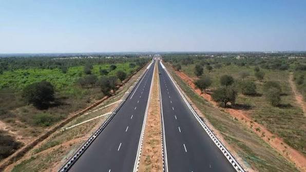
Angamaly-Kundannoor Bypass is the commonly used name for one of Kerala’s most important proposed highway projects around Kochi. The original plan was a roughly 44.7 km greenfield bypass from the Angamaly side to Kundannoor, designed to avoid the congested Angamaly-Edappally section of NH-544 and the Edappally-Kundannoor section of NH-66.
The project changed substantially in 2026. NHAI revised the alignment, extended it south to Aroor and upgraded the concept to an eight-lane corridor. The current proposal is approximately 49.5 km long and is being developed as the Kochi Outer Ring Road/Angamaly-Aroor bypass. Therefore, readers searching for ‘Angamaly-Kundannoor Bypass’ should understand that Kundannoor is no longer the planned terminal point in the latest alignment.
Quick About Angamaly-Kundannoor Bypass
| Particular | Details |
| Project | Kochi Outer Ring Road / revised Angamaly-Aroor Bypass |
| Older Name | Angamaly-Kundannoor Bypass / Kochi New Bypass |
| Approx. Current Length | 49.487 km |
| Older Proposed Length | About 44.7 km |
| Planned Configuration | Eight-lane greenfield highway |
| Starting Side | Angamaly / Kochi Airport side near NH-544 |
| Current Southern End | Aroor on NH-66 |
| Older Southern End | Kundannoor / Nettoor side |
| Major Highways Connected | NH-544 and NH-66 |
| Districts | Ernakulam and Alappuzha |
| Land Acquisition Coverage | 20 villages in the current competent-authority notification |
| Airport Link | Separate direct connector to Kochi Airport under study |
| Current Status | DPR/alignment and land-acquisition process underway in 2026 |
Where Is the Angamaly-Kundannoor Bypass Located?
The planned road runs inland around the eastern and south-eastern side of the Kochi metropolitan area. The current project begins on the Angamaly/Kochi Airport side of NH-544 and continues through parts of Aluva, Kunnathunad and Kanayannur taluks before reaching Aroor in Alappuzha district.
The latest government notification covers a design chainage from 0+000 to 49+487. Villages listed for the project include Karukutty, Thuravoor, Mattoor, parts of Angamaly, Arakapady, Pattimattom, Vadavucode, Aikaranad North and South, Thiruvaniyoor, Marampilly, Vengola, Kureekkad, Kumbalam, Thekkumbhagam, Thiruvankulam, Maradu and Aroor among others.
Why Is the Project No Longer Ending at Kundannoor?
The original scheme was designed to terminate near Kundannoor/Nettoor, but NHAI later concluded that releasing a large volume of bypass traffic into the already congested Kundannoor-Aroor corridor would create another bottleneck.
The revised alignment therefore extends the bypass to Aroor. This allows it to connect more directly with the Aroor-Thuravoor elevated highway and keeps through traffic away from Edappally, Vyttila and Kundannoor.
NH-544 and Angamaly Connectivity
At the northern end, the project connects with the NH-544 corridor around Angamaly. NH-544 is the main road linking Kochi with Aluva, Angamaly, Chalakudy, Thrissur, Palakkad and Coimbatore.
The bypass is intended to divert vehicles before they enter the heavily developed Angamaly-Aluva-Kalamassery-Edappally urban stretch. This is particularly important for long-distance traffic that does not need to enter central Kochi.
Kochi Airport Connectivity
The revised alignment runs close to Cochin International Airport. In August 2026, authorities began studying a dedicated link of about 2 km between the airport and the new outer ring road, with NATPAC involved in the study.
The proposed connector would start from the airport side and join the bypass near Mattoor. It is still a separate planned link and should not be treated as an operational airport road until construction and opening are officially confirmed.
Kunnathunad and Eastern Kochi Connectivity
The route passes through the wider Kunnathunad side, including areas such as Arakapady, Pattimattom, Vadavucode and Aikaranad. These locations place the bypass east of Kochi’s most congested urban corridor.
The alignment is also expected to improve access towards Perumbavoor-side, Kakkanad-side and eastern Ernakulam roads through future interchanges. Final interchange locations should be taken from the approved DPR rather than older route sketches.
Kakkanad, Infopark and SmartCity Side
Although the bypass is designed mainly for through traffic, its eastern alignment can strengthen road access to the Kakkanad technology and administrative belt through connecting roads. Kakkanad, Infopark and SmartCity are major employment destinations in Kochi.
The bypass itself is not planned as an ordinary city street with frequent intersections. Access will depend on the final interchange design, so motorists should not assume direct entry at every nearby locality.
Tripunithura, Maradu and Kundannoor Side
The southern Ernakulam section passes through the wider Thiruvankulam, Kureekkad, Thekkumbhagam and Maradu side before continuing towards Kumbalam and Aroor.
Kundannoor remains an important existing NH-66 junction near Maradu, but it is no longer the latest planned end of the new bypass. This distinction is important because many older maps and reports still show the corridor terminating near Kundannoor.
Aroor and NH-66 Connectivity
Aroor is now the planned southern terminal. NH-66 from this area continues towards Cherthala, Alappuzha, Kollam and Thiruvananthapuram.
The revised terminal is intended to connect with the Aroor-Thuravoor elevated highway, allowing north-south through traffic to move between NH-544 and southern NH-66 without passing through the Edappally-Vyttila-Kundannoor urban corridor.
Railway Connectivity
Because the bypass is a long outer corridor rather than a single locality road, the nearest railway station depends on the section. Angamaly and Aluva stations are useful on the northern side, while Ernakulam Town and Ernakulam Junction serve central Kochi.
Tripunithura and nearby suburban rail points can be useful on the southern Ernakulam side. For long-distance passengers, Ernakulam Junction remains one of the main railway hubs for Kochi.
Airport Connectivity
Cochin International Airport at Nedumbassery is the major airport for Kochi and central Kerala. The new bypass has been planned partly to improve highway access around the airport side and reduce dependence on the congested NH-544 urban stretch.
Until the bypass and the proposed direct airport connector are completed, travellers should continue using existing airport roads and allow extra time for traffic around Angamaly, Aluva and the airport approaches.
Nearby Areas Along the Proposed Corridor
Important northern references include Angamaly, Karukutty, Thuravoor and Mattoor. Farther south, the project affects the wider Pattimattom, Vadavucode, Aikaranad, Thiruvaniyoor and Marampilly belts.
The southern section includes the wider Kureekkad, Thiruvankulam, Maradu and Kumbalam areas before reaching Aroor. The final road will bypass rather than pass through many of Kochi’s central urban hubs.
Is the Angamaly-Kundannoor Bypass Open?
No. The new bypass is not open for traffic in September 2026. The project is still in the DPR, pre-construction and land-acquisition process.
Drivers must continue using existing NH-544, NH-66, Seaport-Airport Road and other Kochi roads. Any map showing the new greenfield alignment should be treated as a proposed route, not a currently usable highway.
Land Acquisition Status: September 2026
The original land-acquisition process lapsed because the required final notification was not completed within the legal time limit. The project was then redesigned, enlarged and extended to Aroor.
On August 13, 2026, the Ministry of Road Transport and Highways issued a notification appointing the competent land-acquisition authorities for the 49.487 km eight-lane Kochi Outer Ring Road. The current schedule covers 20 villages across Ernakulam and Alappuzha districts.
Separate reporting in August said the fresh parcel-level Section 3A acquisition process was being finalised, with authorities aiming to move quickly so that the subsequent 3D process can be completed within the statutory period. Therefore, construction should not be described as having started across the full corridor.
Current 2026 Design and DPR Position
In February 2026, the Union government told Parliament that DPR preparation had been awarded for an approximately 50 km Angamaly-Aroor route. By June, the revised alignment had moved through the Alignment Appraisal Committee process.
The redesign increased the project from the older six-lane, 44.7 km Angamaly-Kundannoor concept to an approximately 49.5 km eight-lane Angamaly-Aroor corridor. Final construction packages, exact interchange details and implementation mode depend on DPR appraisal and subsequent approvals.
What Happened to the Edappally-Aroor Elevated Highway Proposal?
In August 2026, the Union road ministry put the separate 14.64 km Edappally-Aroor elevated highway proposal on hold and indicated that the Angamaly-Aroor bypass would be taken up to address congestion on the Angamaly-Edappally-Kundannoor corridor.
This makes the new outer bypass even more important, but it does not mean the Angamaly-Aroor road is already under full construction. Land acquisition, DPR completion and project approval remain necessary steps.
Toll Information
No operational toll rate exists yet for the new Angamaly-Aroor/Kundannoor bypass because the road has not been built or opened.
Once the highway is constructed, tolling arrangements will depend on the approved project structure and government notification. Travellers should not rely on speculative toll figures circulating before the road is operational.
Conclusion
Angamaly-Kundannoor Bypass remains the familiar name for a project that has changed significantly in 2026. The latest plan is an approximately 49.5 km eight-lane Angamaly-Aroor greenfield corridor connecting NH-544 with NH-66 and the Aroor-Thuravoor elevated highway. It is designed to bypass the congested Angamaly-Aluva-Edappally-Vyttila-Kundannoor urban chain. The project is not open yet; DPR, land acquisition and pre-construction work are still progressing. For current travel, motorists must continue using the existing Kochi highway network.
FAQs About Angamaly-Kundannoor Bypass
Q1. Is Angamaly-Kundannoor Bypass the same as the new Kochi Outer Ring Road?
The older Angamaly-Kundannoor project has effectively evolved into the revised Kochi Outer Ring Road/Angamaly-Aroor bypass. The current alignment is longer and ends at Aroor rather than Kundannoor.
Q2. Has the Angamaly-Kundannoor Bypass opened for traffic?
No. As of September 2026, the project is still in the DPR and land-acquisition stage. Existing NH-544 and NH-66 routes remain in use.
Q3. What is the latest length of the project?
The current official competent-authority notification covers approximately 49.487 km from the Angamaly side to Aroor. The older Angamaly-Kundannoor proposal was about 44.7 km.
Q4. Will the bypass connect directly to Kochi Airport?
The alignment passes close to the airport, and a separate direct connector of about 2 km is under study. That connector is not yet an operational road.
Q5. Why was Aroor added to the project?
Ending at Kundannoor would have pushed bypass traffic into the congested Kundannoor-Aroor section. Extending the route to Aroor allows a direct connection with the Aroor-Thuravoor elevated corridor and avoids more of Kochi’s urban congestion.
Q6. Has land acquisition started again after the earlier process lapsed?
The Centre appointed competent land-acquisition authorities in August 2026 for the revised 49.487 km project, and the fresh acquisition-notification process was being advanced. Full acquisition and possession of land are not yet complete.
Q7. Will the road pass through Edappally, Vyttila or Kundannoor?
The purpose of the revised greenfield route is to bypass these major urban bottlenecks. It runs farther east and south before connecting to Aroor.
Q8. Is there a confirmed toll rate for the new bypass?
No. The road is not operational, so no final user toll for the completed bypass should be quoted yet.