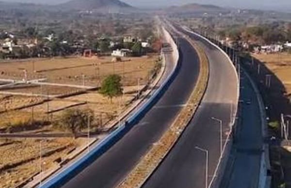
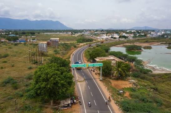
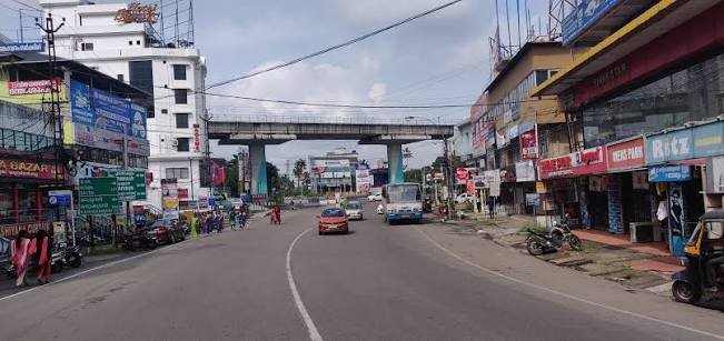
Poonamallee Bypass Road is an important transport corridor on the western side of the Chennai Metropolitan Area. The commonly searched Poonamallee Bypass location lies around the NH-48 Chennai-Bengaluru highway and the Chennai Outer Ring Road connection, close to Poonamallee town. This part of Chennai acts as a western gateway for traffic travelling towards Sriperumbudur, Kanchipuram, Vellore and Bengaluru, while local roads provide access towards Porur, Iyyappanthangal, Kattupakkam, Kundrathur, Avadi and other western suburbs.
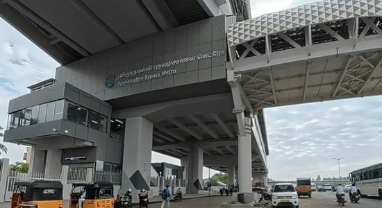
The bypass area is also becoming more important because Chennai Metro Phase II Corridor 4 terminates at Poonamallee Bypass. As of August 2026, the first Phase II section from the Poonamallee Bypass side towards Porur and Vadapalani is awaiting the start of regular passenger services. For people visiting the area, the exact landmark matters because ‘Poonamallee Bypass’ may refer to the highway junction, the bypass-side neighbourhood, a bus pickup location or the upcoming metro station. This guide covers the location, major road links, railway and airport access, public transport, nearby areas, traffic and other practical details.
Quick About Poonamallee Bypass Road
| Particular | Details |
| Location | Western Chennai Metropolitan Area, around Poonamallee |
| Major Highway | NH-48 / Chennai-Bengaluru highway |
| Major Connecting Road | Chennai Outer Ring Road |
| Important Local Roads | Mount Poonamallee Road, Poonamallee High Road and Avadi Road connections |
| Nearby Areas | Poonamallee, Kumananchavadi, Kattupakkam, Iyyappanthangal, Senneerkuppam, Nazarathpet |
| Bus Connectivity | Poonamallee Bus Terminus, MTC buses, autos and cabs |
| Nearest Railway Access | Avadi and Thiruninravur railway stations |
| Metro Connectivity | Poonamallee Bypass station on Chennai Metro Phase II Corridor 4; passenger opening pending as of August 2026 |
| Nearest Airport | Chennai International Airport |
| Road Character | Highway, suburban residential and commercial corridor |
| City / State | Chennai Metropolitan Area, Tamil Nadu |
Where Is Poonamallee Bypass Road Located?
Poonamallee is located on the western side of Chennai in Tiruvallur district and has long served as an important gateway into the city. The bypass area is associated with the NH-48 corridor on the Sriperumbudur side of Poonamallee and the large interchange where the Chennai Outer Ring Road connects with the highway. The location is therefore useful for both city traffic and vehicles that want to move around Chennai without entering the central areas.
Poonamallee town itself lies at the western end of Mount Poonamallee Road and Poonamallee High Road. From the bypass side, travellers can continue west towards Sriperumbudur, move south or north through the Outer Ring Road, or enter the city towards Kumananchavadi, Kattupakkam, Iyyappanthangal and Porur. For navigation, using a complete landmark such as ‘Poonamallee Bypass, NH-48 near Outer Ring Road’ is usually more useful than searching only for Poonamallee.
Connectivity of Poonamallee Bypass Road
Connectivity is the main reason the Poonamallee Bypass area is important. It brings together a national highway, the Outer Ring Road, major western suburban roads, bus services and the emerging Chennai Metro network.
NH-48 and Chennai-Bengaluru Highway
NH-48 is the principal highway connection. From Poonamallee, vehicles can travel west towards Sriperumbudur, Sunguvarchatram, Kanchipuram-side junctions, Vellore and Bengaluru. In the opposite direction, the road network leads towards Chennai through Poonamallee and adjoining western suburbs. The corridor carries local vehicles as well as buses, trucks and long-distance traffic, so conditions can be busy around junctions and peak travel periods.
Chennai Outer Ring Road
The Chennai Outer Ring Road is another major advantage of the location. Near Poonamallee, the ORR connects the NH-48 corridor with areas towards Vandalur and southern Chennai on one side and with Thiruninravur, Minjur and the northern metropolitan belt on the other. This allows through traffic to avoid several congested inner-city roads.
Porur, Iyyappanthangal and Kattupakkam
The city-facing route from Poonamallee connects with Kumananchavadi, Kattupakkam, Iyyappanthangal and Porur. These areas contain large residential neighbourhoods, hospitals, schools, colleges, offices, shops and local markets. Mount Poonamallee Road is particularly important for movement towards Porur, Ramapuram, Nandambakkam and Guindy.
Kundrathur, Avadi and Nearby Suburbs
Local roads also provide access towards Kundrathur and the south-western suburbs, while Poonamallee-Avadi road connections serve Avadi and nearby residential areas. The wider bypass and Outer Ring Road network therefore makes Poonamallee a useful transfer point between several parts of suburban Chennai.
Railway Connectivity
Poonamallee does not have a major suburban railway station within the town centre. The Poonamallee Municipality identifies Avadi as the nearest important railway station, while Thiruninravur is also a practical suburban rail option for some parts of the bypass belt. The preferred station depends on whether a traveller is moving towards central Chennai, the western suburbs or a specific neighbourhood around Poonamallee.
Autos and cabs are normally the easiest way to cover the final distance between the railway station and the bypass. Passengers should keep extra time during busy road periods because the approach roads around Poonamallee can slow down.
Metro Connectivity
Poonamallee Bypass is the western terminal area of Chennai Metro Phase II Corridor 4, which is planned from Poonamallee Bypass to Lighthouse. The corridor includes stations through Poonamallee, Karayanchavadi, Kumananchavadi, Kattupakkam, Iyyappanthangal, Porur and onward towards Vadapalani and central Chennai.
As of the end of August 2026, the first Phase II section has completed major safety and operational preparations, but regular passenger service has not yet begun. The Tamil Nadu government has stated that the initial section from the Poonamallee Bypass side towards Porur is expected to open shortly. Until services officially start, travellers should continue to rely on buses, autos, cabs and existing Metro connections farther inside Chennai.
Bus Connectivity and Poonamallee Bus Terminus
Poonamallee is a major bus interchange for western Chennai. The Poonamallee Bus Terminus serves MTC city routes and other services linking the area with Porur, Koyambedu-side areas, Avadi, Kundrathur and different parts of Chennai. The municipality also describes Poonamallee as an important halting point for buses travelling towards places such as Kanchipuram, Vellore and Tirupati.
Passengers should check the exact boarding point when using private or long-distance buses because some operators use highway-side pickup locations rather than the main town bus terminus. MTC route timings can also change, so current route information is useful when planning a transfer.
Airport Connectivity
Chennai International Airport is the nearest airport. The Poonamallee Municipality places the airport at roughly 20 km from the town, although actual road distance and journey time vary by starting point and route. Travellers generally use roads through Porur and the western-southern city network. Cabs are the most convenient option for passengers carrying luggage or travelling for early-morning and late-night flights.
Nearby Areas Around Poonamallee Bypass Road
- Poonamallee: The main town and commercial centre associated with the bypass, with markets, bus services, schools, hospitals and daily-use facilities.
- Kumananchavadi: Located on the city-facing side of Poonamallee and an important junction on the route towards Porur.
- Kattupakkam: A growing residential locality between Poonamallee and Iyyappanthangal, with apartments, shops and neighbourhood services.
- Iyyappanthangal: A major residential and transport area closer to Porur, served by bus routes and the Phase II metro corridor.
- Senneerkuppam: Situated near the Poonamallee side and connected with the bypass and local road network.
- Nazarathpet: Located close to the NH-48 and Outer Ring Road side, making it a useful reference for highway and ORR access.
- Porur: One of the larger nearby commercial and residential hubs, with hospitals, educational institutions, offices and strong road connections.
Shops and Daily Facilities
The broader Poonamallee area has a well-developed mix of shops, pharmacies, restaurants, banks, ATMs, hospitals, clinics, schools and local markets. Businesses are concentrated around the town centre, bus terminus and the roads leading towards Kumananchavadi and Porur. Highway-oriented services such as fuel stations, vehicle repair outlets, eateries and logistics businesses are also found around the bypass and NH-48 corridor.
For larger hospitals, educational institutions and commercial choices, travellers can also use the Porur-Iyyappanthangal belt. The exact convenience depends on whether a property or hotel is located close to Poonamallee town or farther out near the highway and Outer Ring Road.
Traffic Conditions at Poonamallee Bypass
Traffic can be heavy around Poonamallee because NH-48 highway movement mixes with local buses, two-wheelers, cars, trucks and vehicles entering or leaving the Outer Ring Road. The Poonamallee-Porur corridor has also experienced temporary diversions and lane changes during Chennai Metro construction.
Drivers should follow current road signs and traffic diversions instead of relying only on an older route. During morning and evening peak hours, festival travel and periods of highway congestion, extra time is advisable. People heading to the airport, railway station or a fixed bus departure should keep a reasonable buffer.
FAQs About Poonamallee Bypass Road, Chennai
Q1. Is Poonamallee Bypass the same as Chennai Bypass Road?
Not exactly. Poonamallee Bypass is a local reference around the western end of Poonamallee and the NH-48 corridor. Chennai Bypass Road is a broader highway route connecting different parts of the metropolitan area. Always check the full address and landmark.
Q2. Where should I search for Poonamallee Bypass on a cab app?
Use the complete destination shown in your address or ticket. Adding NH-48, Outer Ring Road, Poonamallee Bypass Metro, Poonamallee Bus Terminus or a nearby establishment can help avoid being dropped at the wrong side of the area.
Q3. Has Poonamallee Bypass Metro started passenger service?
As of August 30, 2026, regular passenger service has not yet started. The first Phase II section has completed major preparations and is expected to open shortly, but travellers should verify the official Chennai Metro announcement before depending on it.
Q4. Which railway station is useful for Poonamallee?
Avadi is identified by Poonamallee Municipality as the nearest important railway station. Thiruninravur is another suburban rail option for parts of the western side.
Q5. Can I get buses from Poonamallee towards other parts of Chennai?
Yes. Poonamallee is a major MTC bus interchange with connections towards Porur, Avadi, Kundrathur and other Chennai localities. Exact routes and timings should be checked on the latest MTC schedule.
Q6. Does the bypass connect directly with the Outer Ring Road?
Yes. The Poonamallee area has an important interchange between NH-48 and the Chennai Outer Ring Road, making it useful for traffic travelling towards Vandalur, northern suburbs and other outer metropolitan areas.
Q7. Are hotels and food options available around the bypass?
Yes. Hotels, restaurants, local eateries and daily-use shops are available around Poonamallee town and the highway corridor. The range is wider towards the town centre, Iyyappanthangal and Porur.
Q8. Is traffic usually heavy near Poonamallee Bypass?
Traffic can become heavy during peak hours because the area handles both suburban and highway movement. Metro-related work or temporary diversions can also affect travel times.